 Punjab is again under water. The Ravi and the Beas have spilled across their floodplains; the Ghaggar has surged; and the Sutlej has been swollen by releases from our great reservoirs, behind our prestigious dams of Bhakra-Nangal and Pong. For many of us, this isn’t just another monsoon story. It is a déjà vu of 1988—the “great deluge”—with uncanny rhymes and troubling differences.
A young officer’s baptism (1984–85)
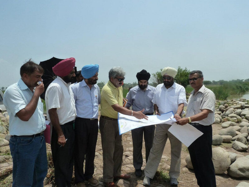
I was inducted into the IAS and allocated to the Punjab cadre on 21 August 1984. As part of our district training in the 1985 monsoon, five of us probationers were deputed to Jalandhar. We were first stationed in the Nakodar subdivision and later Shahkot. That is where I first learnt the names that still define flood risk in Doaba—Gidderpindi, Lohian, Shahkot—and watched the Sutlej threaten to race over at the old railway bridge. We received a crash, three‑hour initiation in rescue, relief and rehabilitation—how to assess losses, how to prioritise evacuations, and how to work across departments when the river decides to set the timetable.
Patiala, 1988: when the city’s own rivers rose
When the epochal 1988 floods hit most of Punjab in September (after Bhakra and Pong brimmed over and floodgates had to be opened), Patiala’s trials arrived in June–July—driven not by the usual suspects on the south‑eastern flank (Ghaggar, Tangri and Markanda), but by Patiala ki Rao and Patiala Badi Nadi. Both breached their bandhs and ran through the city itself.
There is a folklore that the city founded by Baba Ala Singh of the Phulkian lineage (misl) is spared by fire, disease and war, but tested by floods. In keeping with that belief, the then Deputy Commissioner— my immediate boss— requested Captain Amarinder Singh¹—then the city’s titular Maharaj Sahib (head of the erstwhile royal family) and former Agriculture Minister in the dismissed Surjit Singh Barnala government—to offer a gold nath (nose ring) to the rivulet or the stream as propitiation.
While this ritual played out, the bureaucracy did its duty. As Additional Deputy Commissioner, I received a wireless from the Financial Commissioner Revenue that he was landing at the Patiala Aviation Club in the state aircraft. In the era before mobiles and reliable telephony, I failed to trace the Deputy Commissioner in time. I received the FCR at the airstrip, escorted him through our relief and rehabilitation centres, and then briefed him at the Circuit House. He was satisfied with the preparedness and less than amused by superstition; the Deputy Commissioner, when he arrived, got a dressing down. A few days later, J. F. Ribeiro—then leading Internal Security, with K. P. S. Gill having been given full operational charge of the Punjab Police during President’s Rule—also visited. He, too, was complimentary about the district administration’s leadership. Soon after, I was posted as the first District Magistrate of the new district at Batala—both to pre‑empt flooding in the Ravi–Beas belt and to ensure human‑rights‑respecting law‑and‑order under testing conditions. The floods were managed without major tragedy.
The hydrology then and now
In 1988, Ravi was essentially untamed. Ranjit Sagar (Thein) was still under construction; Shahpur Kandi downstream had not broken ground; Madhopur was an ageing British‑era headworks; and the Upper Bari Doab Canal could not double as a flood escape in monsoon when irrigation demand was negligible. When cloudbursts arrived and Bhakra (on the Sutlej) and Pong (on the Beas) filled rapidly, releases were inevitable and, with them, widespread inundation. Ludhiana’s decades‑old Budha Nullah back‑flowed, urban drains were overwhelmed, and inter‑district frictions—Jalandhar defending its right bank while Ludhiana, with an adverse slope, absorbed the brunt—showed the cost of district‑wise reaction to basin‑scale floods.
In 2025, we have more infrastructure and less margin for error. Ranjit Sagar (Thein) has been operational for years, but the Madhopur headworks suffered catastrophic gate failures this monsoon, degrading regulation on the Ravi exactly when high inflows surged. Shahpur Kandi Dam is largely built but has not been fully operationalised on a firm rule‑curve regime; that missing link was felt keenly this season. Bhakra and Pong again approached their upper limits; Harike and Hussainiwala ran huge discharges into already saturated floodplains; the Ghaggar and its Shivalik tributaries (Tangri, Markanda, Kaushalya, Patiala Badi Nadi, Patiala ki Rao, Sirhind Choe) spiked with convective rain episodes. Cross‑border hydraulics on the Ravi complicated matters further along the international boundary.
A practical clarification: “Why not send it into the Rajasthan (Indira Gandhi) Canal from Harike?”
This question surfaced repeatedly. At Harike, the Rajasthan Feeder (Indira Gandhi Feeder) and the Ferozepur Feeder exist for irrigation and drinking water. In flood time, however, two hard constraints apply:
Demand: When command areas in Rajasthan and south‑west Punjab are already water‑logged or out of irrigation season, there is no offtake demand; canals cannot be safely run full into fields that do not need water.
Capacity: Even on paper, the Rajasthan/Indira Gandhi Feeder is in the ~15,000–18,500 cusecs band at head. In contrast, Harike’s flood releases this monsoon were in excess of a lakh cusecs at various points. No canal system can swallow “multiple lakhs” without catastrophic failure of banks and structures.
Therefore, beyond limited diversion into feeders, the only plausible and safe alternative in peak hours was to pass the balance downstream of Harike—which, given the course of the Sutlej–Beas–Ravi system, means water moving towards and across the international boundary. That is hydraulics, not geopolitics.
The Dam Authorities’ Dilemma: Between Conservation and Calamity
The custodians of our great reservoirs, whether the BBMB or the Ranjit Sagar Dam— live with a perennial dilemma. The rainfall predictions of the IMD have been erratic, leaving dam managers to steer between two unpalatable extremes. If they begin releasing too early, they are accused of wasting precious water needed for irrigation and drinking supply in the lean months. Yet if they delay the opening, and the rains arrive in the form of sudden cloudbursts, they face the double burden of natural inundation and forced releases from brimming reservoirs. In those hours, every discharge adds to already drowned floodplains, compounding both the human misery and the criticism. It is a cruel paradox—damned if they open, damned if they don’t—that calls for more agile forecasting, flexible rule curves, and transparent public communication.
Ravi at the Indo-Pak Border: Hydrology and National Security
The Ravi poses a peculiar strategic and hydraulic dilemma. Downstream of the Madhopur Barrage, the river gathers tributaries—Jalali, Unjh, Basantar and others—that compound its discharge just when regulation is most needed. The natural slope of the land favours Pakistan’s right bank, leaving our side lower and more vulnerable to spill. Across the border, the Pakistan Army has for decades hardened its embankments with concrete revetments and bunkers, while on our side the bunds remain porous, pitted with breaches and unauthorised cuts. In effect, the geometry of the floodplain and the asymmetry of preparedness give us very limited room for manoeuvre. Each season when inflows surge beyond design capacity, the Ravi threatens not only villages and fields in Ajnala and Dera Baba Nanak sectors, but also border infrastructure and barbed-wire fencing—reminding us that this is a river which, if left untamed, plays into the calculus of both hydrology and national security.
Monsoon volatility: Outlier rain in the Himalayan catchments still compresses storage and release decisions into perilously short windows.
Silt and encroachment: Choked choes, neglected desilting, fragile dhussi bandhs, and building in floodplains amplify damage.
Urban vulnerability: Budha Nullah in Ludhiana, Patiala’s Rao and Badi Nadi, and the choes of SAS Nagar and Chandigarh remain weak links when drainage is blocked or backflowed.
Basin‑scale coordination gaps: Rivers don’t respect district boundaries. Fragmented control rooms translate into local “wars” of embankments and ad‑hoc cuts.
What is different
Assets & failure modes: We now have large storages (Thein/Ranjit Sagar) and headworks chains—so failure at a node (like Madhopur) cascades across the system.
Rule curves & flood cushion: Climate‑changed rainfall patterns and siltation demand more dynamic, pre‑monsoon drawdown policies than the legacy rule curves used in the 1980s.
Technology & communications: Satellite‑derived nowcasting, Doppler radars and mobile alerts exist—yet when last‑mile coordination is weak, their benefits don’t fully reach embankment crews or villagers.
International border hydraulics: The Ravi and Sutlej now routinely create simultaneous humanitarian challenges on both sides of the fence; without joint readiness, the side with the weaker flood defences pays more.
The British‑era protocol—codified, but honoured in the breach
The protocol is well codified in the Revenue Department’s manuals. Post‑monsoon, a committee led by the Deputy Commissioner must inspect flood‑protection works, map breaches and weak spots, and put up estimates for repair through the Drainage Wing of the Irrigation Department. Pre‑monsoon, the same committee verifies that those works are actually completed—embankments strengthened, gates and hoists serviced, choes de‑silted, borrow‑pits filled, and evacuation rehearsals done with men and material pre‑positioned.
In practice, this ritual is too often observed in the breach: files move late, tenders are split, funds are “not available,” and politics intrudes as each constituency seeks to “save” its patch—sometimes by pushing water to a neighbour. In 2017, as Financial Commissioner (Revenue), I saw how protection works on the Jalandhar bank inadvertently deflected flows toward the Mattewara–Sidhwan belt on the Ludhiana side, inundating several villages. The lesson was not about fault‑finding; it was about basin‑scale thinking and the cost of acting district‑by‑district.
What we need is a culture of verification, not assumption: third‑party QC of pre‑monsoon works; hard deadlines in April–May; and public dashboards so citizens can see which reach has truly been made monsoon‑ready.
Field vignette (2017): Mattewara–Sidhwan—when a protection work became a problem
Toward the final phase of my service, in 2017 as Financial Commissioner (Revenue), I spent a long monsoon day along the Sutlej’s left bank in the Mattewara–Sidhwan belt with the district teams. The river was rising, and both Ludhiana and Jalandhar administrations were working at pace. Upstream, on the opposite bank, an emergency “heightening” of a local protection embankment had been executed with sincere intent—to keep water off a vulnerable hamlet. On site, however, our engineers showed how that unilateral raise had narrowed the effective floodway at a bend and pushed the thalweg toward the Ludhiana side. The result was predictable: faster velocities along our bank, overtopping of low‑lying approach roads, and loss of free fall in local drains that were trying to outfall into the Sutlej.
We convened a joint huddle on the embankment itself—two Deputy Commissioners, the Chief Engineer (Drainage), field XENs/SDOs, and the police. The decisions were plain, if unpopular: pause further heightening upstream unless hydraulically cleared; re‑profile a short reach to restore floodway width; de‑choke culverts to give the backwater an exit; and place monitoring pegs with hourly gauge readings so that any rise was caught before dark. We also posted a single point of command for both banks for the next 48 hours—no “good deeds” to be done in isolation, however well‑meant.
By late evening the levels stabilised. We still had pockets of water and damage, and we still needed boats and rations. But the larger lesson was etched in my notebook: never raise an embankment on one bank without cross‑bank concurrence and a quick hydraulic check. I carried that line back into our pre‑monsoon circulars the following year. It is a small rule, learnt in gumboots, that saves real homes. On paper, Punjab’s post‑ and pre‑monsoon inspection system is sound. A Deputy Commissioner‑level committee must: (i) post‑monsoon: map breaches, assess damage, prepare estimates, and secure timely sanctions; (ii) pre‑monsoon: verify completion of works, certify embankments and gates, rehearse evacuations, and pre‑position men and material. Where we falter is execution—late tenders, piece‑meal repairs, poor QC of gates and hoists, encroachment toleration, and weak cross‑district drill. When a headworks collapses or a railway bridge choke is left uncleared, months of planning can be lost in an hour.
The Ghaggar–Tangri–Markanda paradox (and the Saraswati memory)
The Ghaggar is, by hydrology, a seasonal river; by memory, many link it to the vanished Saraswati. Its two restless tributaries—Tangri and Markanda—rise in the Shivaliks, race through built‑up plains, and often converge near Khanori and Munak. In bad years, Punjab and Haryana play hydraulic chess, trying to bend the sheet‑flow away from habitations and, too often, towards one another. Downstream, the river loses itself in the Thar; upstream, it can overwhelm.
Two practical points follow:
We can tame a seasonal river without pretending it is perennial. That means widening floodways at choke points, building sacrificial washlands with guaranteed compensation, and creating engineered flood escapes that do not fail catastrophically.
The SYL as a drainage barrier. Dug largely in 1985–87, the Sutlej–Yamuna Link cuts across natural ground slopes and thus acts as a weir when the flood sheet arrives. Cross‑drainage works exist but are nowhere near adequate for present‑day extremes. The result: major sheet‑flooding across SAS Nagar (Mohali), Rupnagar (Ropar), Fatehgarh Sahib and parts of Patiala.
What’s needed is a Ghaggar Basin Compact—a joint Punjab–Haryana flood cell with shared telemetry, common embankment standards, a pre‑agreed playbook for controlled cuts, and a legally backed compensation formula.
Policy lessons and an expanded agenda
Finish Shahpur Kandi—then operate it well: Commission fully with an agreed, climate‑aware rule curve and transparent daily dashboards shared with J&K and BBMB. A functional Shahpur Kandi is the missing second stop‑cock on the Ravi.
Rebuild Madhopur for floods, not just for canals: Replace/retrofit gates, hoists and piers to modern standards; design for extreme flows; add redundancy; and run annual third‑party audits pre‑monsoon. The UBDC’s nominal 9,000‑cusec capacity is irrelevant when irrigation demand is near‑zero in monsoon; we need a dedicated flood escape that can be safely used without endangering canal banks.
Dynamic reservoir operations: Update Bhakra and Pong rule curves to create seasonal flood cushions using ensemble forecasts. Pre‑empt releases before catchment cloudbursts, not after.
Basin‑level Joint Flood Cells: Create unified, cross‑district command cells for the Sutlej–Beas and Ravi basins with single‑channel public messaging, shared telemetry, and pre‑agreed playbooks for controlled cuts and evacuations. End the inter‑district “tug of war”.
Clear constrictions before the sky opens: Institutionalise May–June desilting of critical choke points—Gidderpindi rail bridge (Sutlej), Goindwal (Beas), Sirhind and Hussainiwala heads, and under‑passes—backed by independent verification and penalty clauses.
Urban drainage as critical infrastructure: Treat Budha Nullah, Patiala ki Rao, Badi Nadi, N‑Choe, Sukhna Choe and Sirhind Choe with the same seriousness as highways—encroachment removal, backflow gates, pump‑and‑store plans, and wetland buffers.
Border‑zone flood defence compact: Along the IB, harden embankments and culverts in consultation with BSF and the Centre; create a joint SOP for when and how to sacrifice agricultural land to save habitations, with guaranteed and swift compensation.
People‑centred early warning: Push alerts in Punjabi and Hindi with hyperlocal gauges, and link to village‑level volunteers, NDMA/NDRF playbooks, and evacuation transport rosters.
Relief that respects dignity: Standardise cash‑plus‑kind packages, parametric crop insurance triggers (rainfall + river gauge), and simplified claims—so families aren’t asked for documents they lost to the water.
A Floods Code for Punjab: Enact a state‑level floodplain zoning and critical‑asset protection code, aligned to the Panchayat and Municipal Acts, with teeth against illegal construction on riverbeds and embankments.
Additions for 2025 (beyond the ten points)
SYL Drainage Masterplan: Treat the canal as a barrier in flood mode. Add aqueducts, syphons, culverts and seasonal pump‑bys at pre‑identified low points; build overflow basins where gravity drainage is impossible; test options on a digital twin before the monsoon.
Punjab–Haryana Ghaggar Accord: A basin‑level compact with a permanent joint control room, shared gauges, and a rule‑book for flood‑escapes, controlled cuts and relief. Pre‑monsoon canal lowering to create drainage head where feasible.
The Ready‑Boat Programme: Procure/lease a district‑wise fleet of motorised boats; run a May “float test” on live canals; maintain decentralised caches with fuel, life‑jackets and searchlights; train volunteers with SDRF/NDRF. Boats must not die in Secretariat parking lots—they must live by the water.
Humanitarian coordination with NGOs: Stand up District Humanitarian Coordination Cells led by the DC and SSP. One public number/app for supply offers and needs; daily postings of priority villages; geo‑tagged drop‑offs to avoid duplication and gaps.
Funding and accountability: Ring‑fence a Flood & Drainage Fund; enforce third‑party QA/QC; publish pre‑monsoon readiness dashboards; and mandate post‑monsoon audits with penalties for non‑completion or poor workmanship.
A note on ‘water‑as‑weapon’ punditry—and IWT realities
In the heat of television debates and social media, some commentators—including a few retired generals—have proclaimed that India now wields a “water warfare weapon.” This is cheerleading for narrow political angles and unhelpful to serious policy. The Indus Waters Treaty (1960) assigns the Eastern Rivers—Ravi, Beas, Sutlej—100% to India’s use and the Western Rivers—Indus, Jhelum, Chenab—predominantly to Pakistan, with limited, specified uses for India. Our first task is to tame and manage our own Eastern system—where even today we struggle with silt, encroachment, fragile headworks and legacy rule curves. Talk of “weaponising” the Western rivers in the middle of a deluge ignores hydrology, treaty constraints, engineering lead times and the humanitarian reality on both banks.
Could India develop additional storages and diversions within treaty limits? Yes—but over years, more likely decades, unless executed as national projects under a single, competent, apolitical agency. That path demands fiscal commitment, basin‑wide design, and, above all, respect for riparian rights—not hydraulic one‑upmanship.
As to the SYL Canal, it has become an emotional ulcer for Punjab and a physical barrier in flood mode. My view is that it deserves a dignified burial—literally and figuratively—even if that calls for a central enactment. We are one country; basin‑based use must prevail over parochial ultimatums. Otherwise, floods will be followed by years of drought politics—the next weak monsoon may see states clamouring for drinking water, and even a modest 8,000‑cusec release from Bhakra could become a manufactured crisis. The Sikh ethic of Bhai Ghanaiya Ji—water for the wounded without asking “ours” or “theirs”—should guide public leadership, not headline hunting.
After the waters recede: blame vs. mitigation
When rivers spread across their floodplains, they are obeying physics, not party lines. Natural calamities aren’t in human hands; mitigation is. It is tempting to moralise about receding glaciers and global climate change; it is better to fix gates and culverts in April, rehearse evacuations in May, and honour the manual in June. VIP cavalcades and social‑media theatrics cannot substitute for boats at the ghat, telemetry at the headworks, or a single command channel across a basin.
The land of five rivers—now effectively three within Punjab’s borders, with the Ghaggar as our “half‑river”—will see floods again. Whether they become disasters depends on whether we choose dashboards over alibis, drills over press notes, and solidarity over hydraulic one‑upmanship.
Closing note
Punjab has learnt these lessons before—1988, 1993, 2019, 2023—and yet we keep re‑learning them at terrible cost. The river is not our enemy; our complacency is. With modern engineering, realistic operations, and disciplined coordination, the next “great deluge” need not become another chapter of preventable loss. The time to act is in April, not August.
As Shakespeare reminds us: “There is a tide in the affairs of men, / Which, taken at the flood, leads on to fortune.” (Julius Caesar IV.3). The irony, as well as the relevance, could not be sharper: to act at the flood is to risk calamity, to act before it is to seize fortune. And while chief ministers may come and go, vying to say in effect “After me, the deluge,” our rivers—like Tennyson’s brook—will, one hopes, “go on for ever.”
The call, then, is not for cheerleading or blame, but for a statesmanlike acceptance of hydrological reality, a culture of preparedness, and a commitment to spare Punjab’s people the needless repetition of old miseries.