
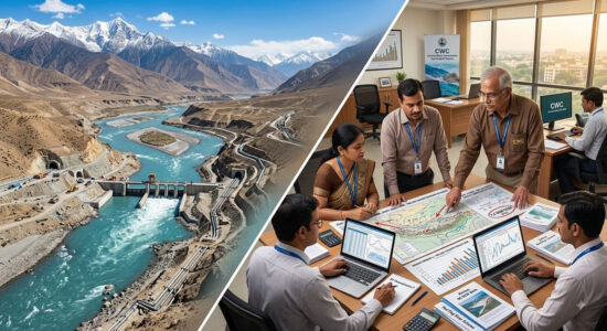
 On 11 August 2026, Xinhua carried an announcement that ought to have earned more Indian editorial attention than it did. The first phase of China’s South-to-North Water Diversion Project — the Nanshui Beidiao Gongcheng, the largest water diversion initiative on the planet — has now transferred a cumulative 90 billion cubic metres (~73 MAF) of water since its eastern and middle routes became fully operational in 2014. The middle route alone accounts for over 80 BCM (~65 MAF); the eastern route for nearly 10 BCM (~8 MAF). Forty-eight major cities and 195 million people have received a stable, high-quality supply from it. More than 13 BCM (~10.5 MAF) has additionally been diverted for the ecological replenishment of over fifty rivers along the routes.
I want to set out, briefly and without either alarm or admiration, what those numbers actually mean — and why they suggest that a good deal of Indian commentary on Chinese water infrastructure, my own earlier drafting included, may have been overestimating Beijing’s actual diversion muscle by something approaching an order of magnitude.
Ninety BCM (~73 MAF) over twelve years averages roughly 7.5 BCM (~6.1 MAF) per year across the two operational routes — the middle route carrying some 6.7 BCM (~5.4 MAF) annually across a corridor of approximately 1,200 kilometres, and the eastern route another 0.8 BCM (~0.65 MAF) across nearly 1,150 kilometres. The middle route runs from the Danjiangkou Reservoir on the Han River to Beijing and Tianjin; the eastern route from the lower Yangtze, using the Grand Canal alignment, to the North China Plain. Both were commissioned in 2014. A third — the far more contentious Western Route, which would draw from the Tibetan Plateau — remains in the study stage, and it is in the same geographical neighbourhood as the Yarlung Tsangpo Great Bend that I have written about at length in earlier Chronicle pieces.
To place the annual volume in an Indian frame of reference: 6.7 BCM (~5.4 MAF) per year is roughly comparable to what the Bhakra reservoir holds as live storage. India, in other words, is being shown a project that transfers, every year, across a distance greater than Delhi-to-Mumbai, a volume of water comparable to what our own largest multipurpose reservoir simply holds. The scales are not directly comparable — the two are different engineering categories — but the comparison is instructive precisely because it collapses two distinctions Indian planning tends to keep separate: the distinction between storage and conveyance, and the distinction between an announcement and a delivery.
Here is where the announcement invites some honest self-audit on the Indian side of the debate.
Much of the Indian commentary on the Yarlung Tsangpo Medog project — including the popular “100 BCM” (~81 MAF) figure I disposed of in my earlier discussion paper as a misapplied Three Gorges storage ratio — has drifted into treating Chinese diversion capacity as though it were a limitless variable, constrained only by Beijing’s intent. The proposals most often cited to justify this framing are two: the Guo Kai “Tibet–Tianjin canal” proposal, which envisages diverting some 200 BCM (~162 MAF) annually from the Yarlung Tsangpo to the Yellow River basin; and the Gao Gan “Red Flag River” scheme, at roughly 60 BCM (~49 MAF) annually. Both remain unofficial, and both, as I noted in the earlier paper, are advocated by figures with institutional standing rather than by the Ministry of Water Resources.
Set the Gao Gan figure against the Xinhua announcement. The South-to-North Water Diversion Project — Beijing’s largest, most institutionally serious water-diversion initiative to date, running across some 2,350 kilometres of combined corridor and enjoying more than a decade of consolidated operational history — is delivering, cumulatively, an average of 7.5 BCM (~6.1 MAF) per year. Even the middle route alone, which is the more mature of the two operational routes and closer in engineering conception to any future Western Route, delivers 6.7 BCM (~5.4 MAF) per year.

The Gao Gan “Red Flag River” figure of 60 BCM (~49 MAF) per year is therefore roughly eight to nine times what the entire Nanshui Beidiao project has demonstrated it can move across its two operational routes combined. The Guo Kai proposal at 200 BCM (~162 MAF) is nearly thirty times that figure. Neither number is impossible in some abstract engineering sense. But both would require Beijing to build, on a river with far more challenging topography and seismicity than the Han or the Yangtze, and in a border region requiring an unprecedented mobilisation of capital and diplomatic risk, a diversion capacity roughly one order of magnitude greater than what China has demonstrably built anywhere else on its own territory over twelve consolidated years of operation.
That does not make Indian concerns about the Yarlung Tsangpo project misplaced — I still stand by the disclosure demands set out in my earlier discussion paper: live storage, operating rules, release-point coordinates, tunnel capacity, emergency-release protocols. Beijing has withheld all of these, and India is entitled to press. But it does mean that the scale at which some Indian commentary has framed the diversion threat needs a serious recalibration against what China has actually delivered on its most institutionally consequential water project. The gap between “80 BCM (~65 MAF) diverted over 12 years across two mature routes” and “60 BCM (~49 MAF) diverted per year through a single Tibetan corridor” is not an incremental difference. It is roughly an eight- or nine-fold overreach.
I want to be precise about what I am not arguing.
I am not arguing that the Medog project is benign. My earlier paper set out four categories of real risk — timing, sudden release, sediment starvation, and data asymmetry — that do not depend on any large diversion volume and remain live concerns even on the plainest run-of-river reading of the project’s design.
I am not arguing that China is engineering-limited in some permanent sense. The 90 BCM figure is a demonstration of a demonstrated execution rate, not a ceiling on future capacity. Beijing could, in principle, treble that figure over the next decade if it committed to the Western Route with the seriousness it committed to the eastern and middle routes in the 2000s.
And I am not arguing that Indian anxiety about the Brahmaputra should now be relaxed. What I am arguing is that Indian anxiety should be calibrated. The realistic upper bound of what Beijing might divert from the Yarlung Tsangpo, on the twelve-year evidence of what it has actually delivered on Nanshui Beidiao, is far closer to the 5–15 BCM (~4–12 MAF) annual band than to the 60–200 BCM (~49–162 MAF) band the alarmist framing has periodically implied. That is a very different kind of threat — smaller in aggregate volume, but capable of doing damage through timing and seasonality rather than through outright depletion. And it is precisely the calibrated threat that a competent Indian policy response ought to be built around.
What It Ought to Say to India
Set aside for a moment the environmental costs of the Nanshui Beidiao project, which are real and have been documented by Chinese and international researchers alike — the displacement of some 3,45,000 people in the middle route’s construction, the ecological changes to the Han River, the concerns about water quality on the eastern route. What remains, on the plainest reading of the Xinhua announcement, is a demonstration of an executive capacity to translate long-planned water infrastructure into operational reality on a schedule that Indian federalism has, over the same period, been unable to match on projects a fraction of the size.
The announcement’s own language is worth attending to. Water networks are described as one of six major national infrastructure priorities. The project is characterised as the “backbone and artery of the national water network.” The “main framework” is said to be “continuing to improve.” This is the vocabulary of a state that treats water infrastructure as a first-order strategic asset, not a residual category left over after the political calendar has attended to caste, freebies, roads, and identity.
Over the same twelve years — 2014 to 2026 — India has produced the following record. Shahpur Kandi on the Ravi was commissioned in 2024 after twenty-eight years of interstate cost disputation. Polavaram on the Godavari remains incomplete. The Ken–Betwa link, the country’s most modest attempt at interlinking, is under construction after decades of preparation. The Sutlej–Yamuna Link canal is a constitutional wound rather than a project. The Cauvery dispute continues to require Supreme Court intervention each deficient monsoon. Mumbai floods every year. Gurugram floods every year. Bhakra’s rule curves have not been publicly revised. And the Punjab groundwater table falls between half a metre and a metre each year — the fastest aquifer collapse in the country — while the state’s paddy farmers continue to draw free power on unmetered pumps.
I do not offer this contrast in the spirit of self-flagellation, which is unproductive, or of admiration for authoritarian efficiency, which is unwarranted. The point is narrower, and I have made it in the longer discussion paper this Chronicle piece will link to. India does not lack engineering capacity, money, or law. It lacks priority. And the priority a state assigns to water infrastructure is revealed not by what it announces at press conferences but by what it delivers on a twelve-year horizon.
A Modest Refrain
I have, in the longer discussion paper, put a question I intend to keep putting: if the China factor bedevils the Brahmaputra, why can we not resolve the Cauvery? The Xinhua announcement invites a small addition to that question. If China can move ninety billion cubic metres of water across twelve hundred kilometres of its own territory in twelve years — no more, and no less — then two things follow. India’s anxieties about the Yarlung Tsangpo, though legitimate, ought to be recalibrated against that realistic delivery ceiling. And India’s own record on the sovereign rivers within its own map ought to be audited against the same twelve-year yardstick.
That is not a question that has a comfortable answer. It is, however, a question we owe ourselves. And it is one that will not be answered by a yagam on the banks of the Nagarjuna Sagar, or by a Cessna over Karol Bagh, or by the next NITI Aayog paper announcing the next headline project.
It will be answered — if it is answered — by the boring, cumulative, decade-spanning work of institutional seriousness that produced the 90 BCM figure Xinhua announced this week. That, and not the yagam, is the answer worth building.